Name/Title
Topos: Part One: A Topographical Map of Milwaukee's East SideContext
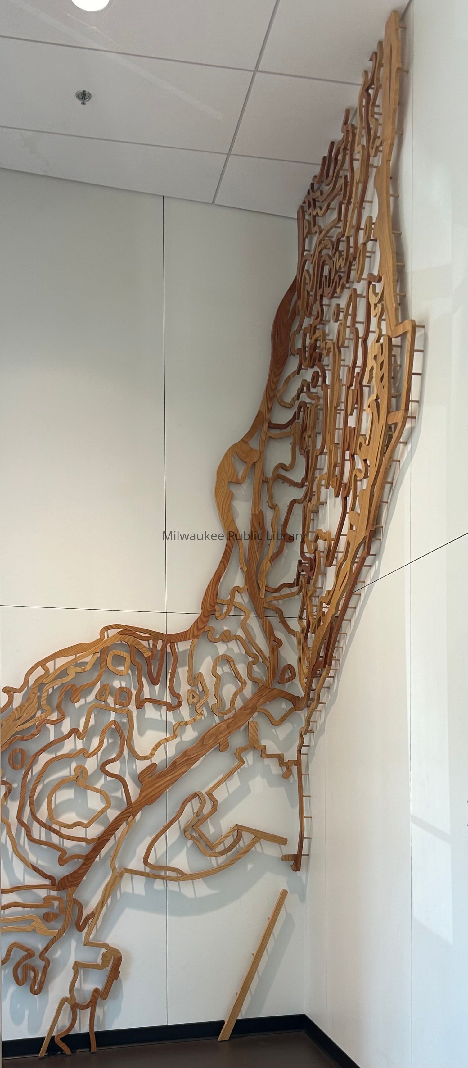
"…a topographical map of Milwaukee's East Side installed on the 16' walls. Occupying 4 square miles, the East Side extends north-south from Capitol Drive to the Milwaukee River defining the Third Ward's southern edge and west-east, from the Milwaukee River to Lake Michigan. This map is CNC-cut from reclaimed Honey Locust and Ash trees. Working closely with the City of Milwaukee's Urban Forestry Department, the wood used in this project was from the trees previously located just out the front door." [From East Library brochure issued by MPL]Collection
Wisconsin Art Collection, Artwork CollectionAcquisition
Accession
2014.2Source or Donor
Kathryn E. Martin