Name/Title
Old California Illustrated MapEntry/Object ID
NU 2021.291Secondary Title
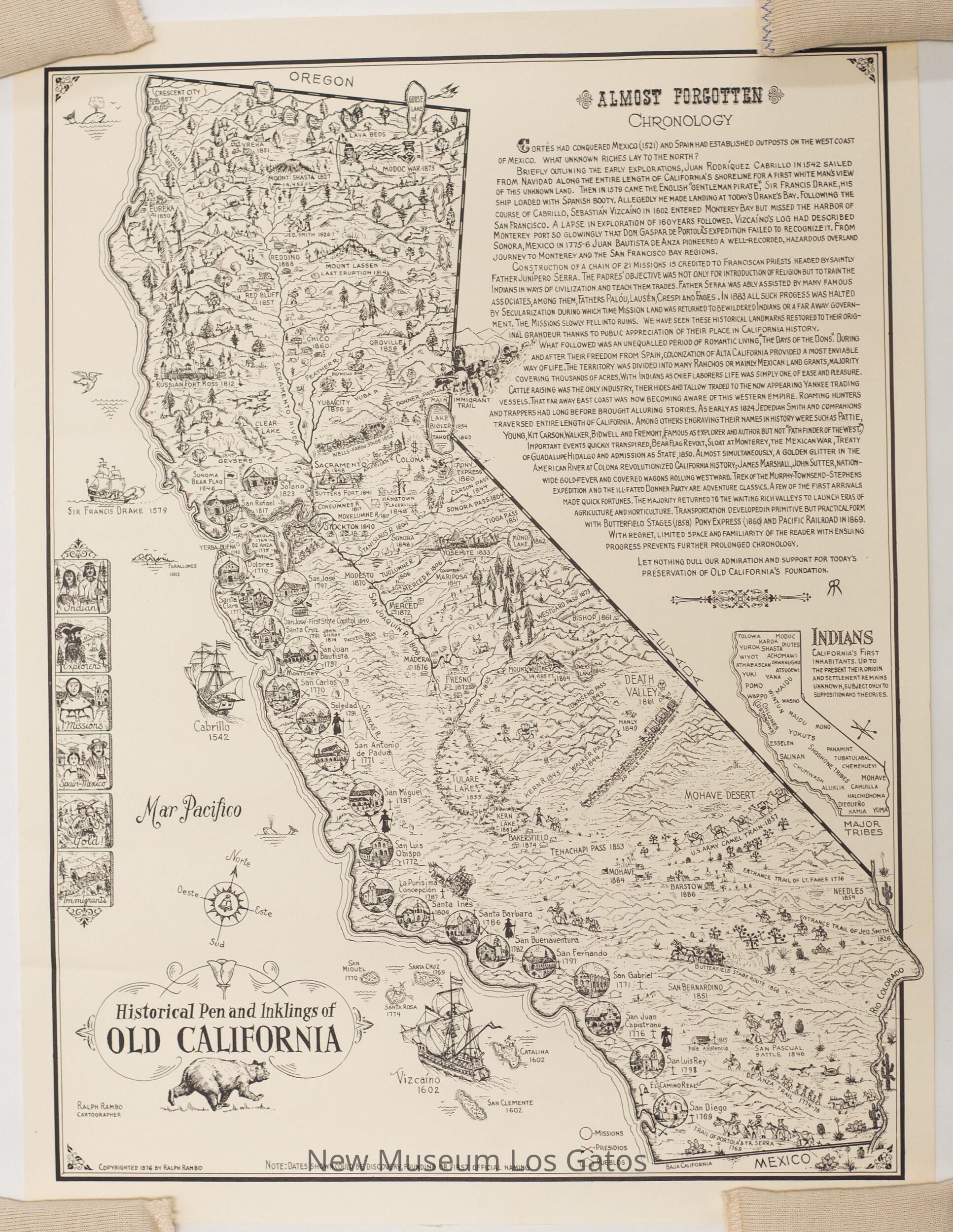
Historical Pen and Inklings of Old CaliforniaDescription
A hand-illustrated, black and white map of California, depicting the location of the missions and other notable natural locations and thoroughfares. The mapmaker has included a history of California in the upper right corner, as well as a smaller map of California, depicting ancestral native territories.Collection
History CollectionCataloged By
registrar@numulosgatos.orgLexicon
Nomenclature 4.0
Nomenclature Secondary Object Term
MapNomenclature Primary Object Term
CartographNomenclature Sub-Class
Graphic DocumentsNomenclature Class
Documentary ObjectsNomenclature Category
Category 08: Communication ObjectsMap Details
Maker or Creator
Ralph RamboArea or Region
State/Province
CaliforniaCountry
United States of AmericaContinent
North AmericaIllustrator
Ralph RamboDate Published
1976Medium
PaperPublication Language
EnglishDimensions
Width
16 inLength
21-1/4 inDimension Notes
Measurements taken while lying as flat as possible