Name/Title
Yosemite National Park Road MapEntry/Object ID
NU 2022.411Description
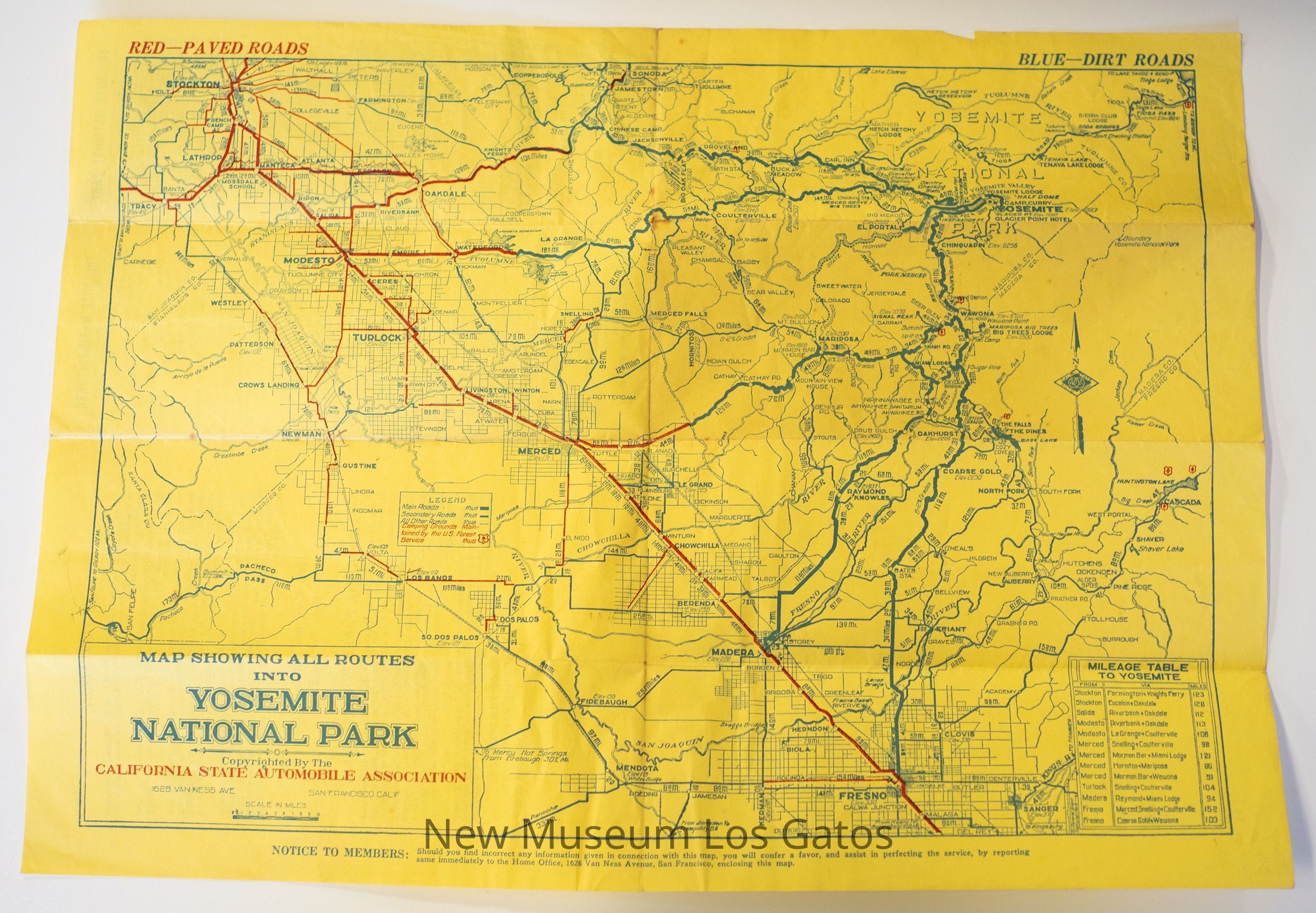
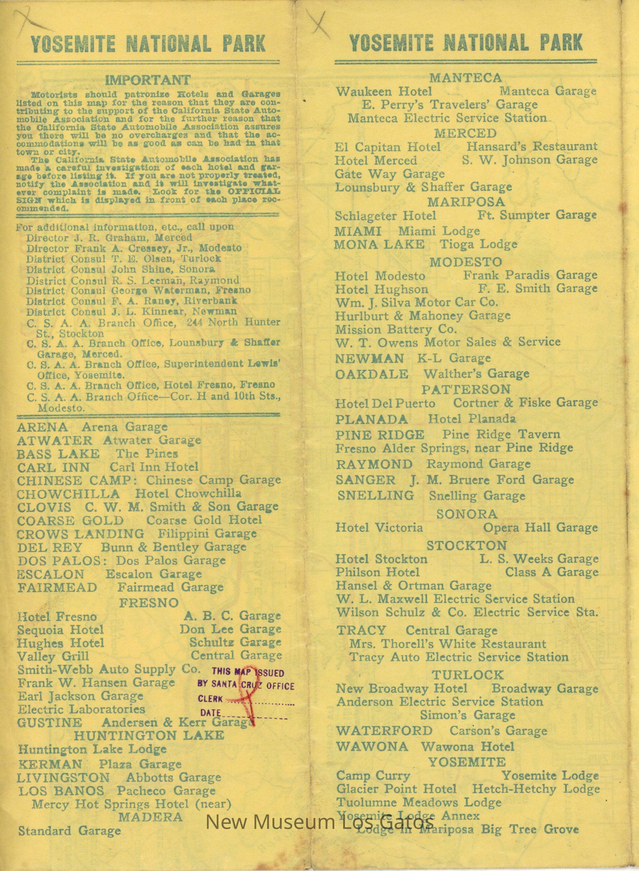
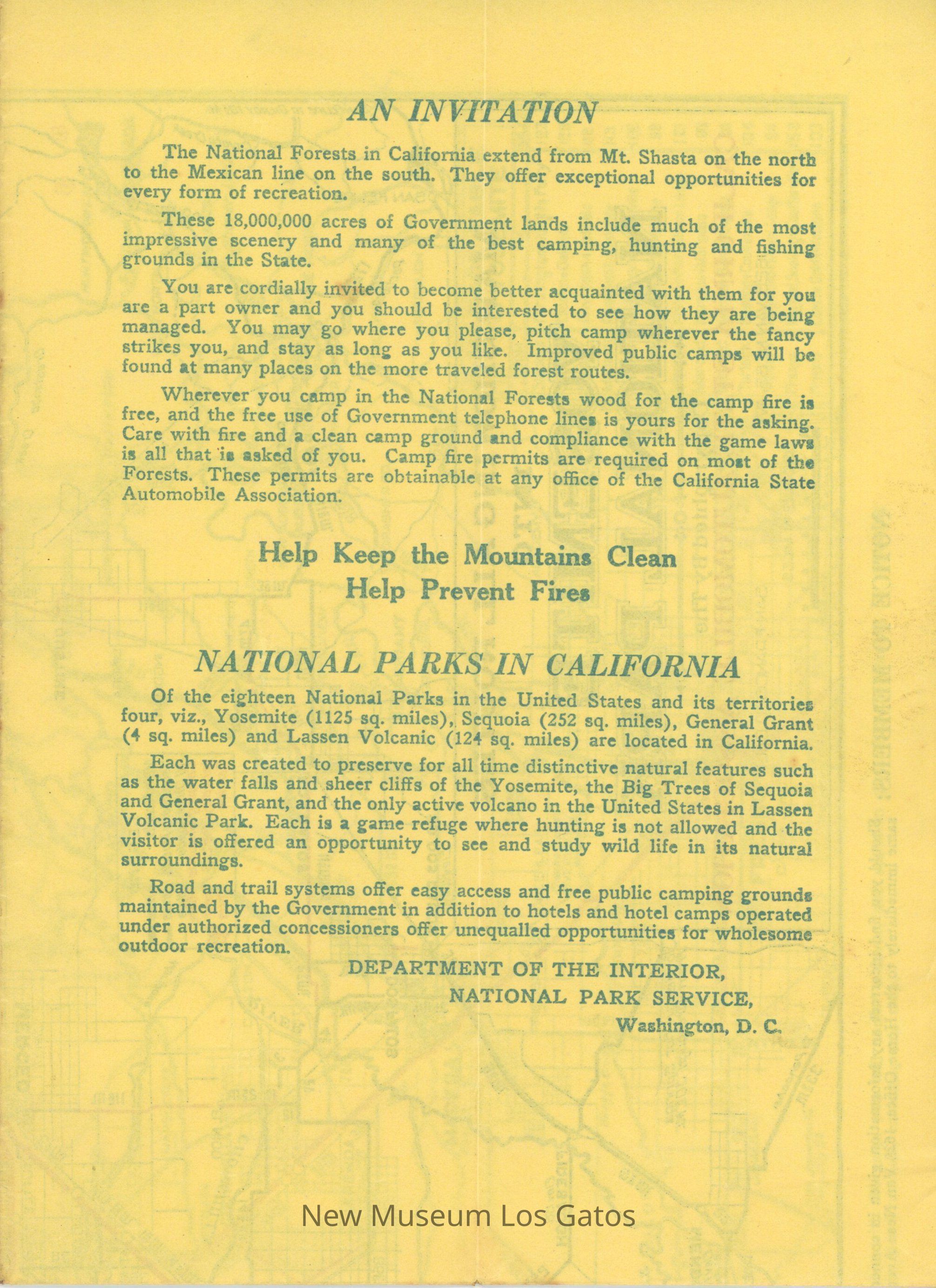
A foldable map, depicting the roads, both paved and unpaved, that lead into Yosemite National Park. There is also information about Yosemite National Park, where to stay near the park, and about national parks in general.Collection
History Collection, Rankin CollectionCataloged By
registrar@numulosgatos.orgLexicon
Nomenclature 4.0
Nomenclature Tertiary Object Term
Map, RoadNomenclature Secondary Object Term
MapNomenclature Primary Object Term
CartographNomenclature Sub-Class
Graphic DocumentsNomenclature Class
Documentary ObjectsNomenclature Category
Category 08: Communication ObjectsMap Details
Area or Region
Region
Yosemite National ParkState/Province
CaliforniaCountry
United States of AmericaContinent
North AmericaPublisher
California State Automobile AssociationPublication Language
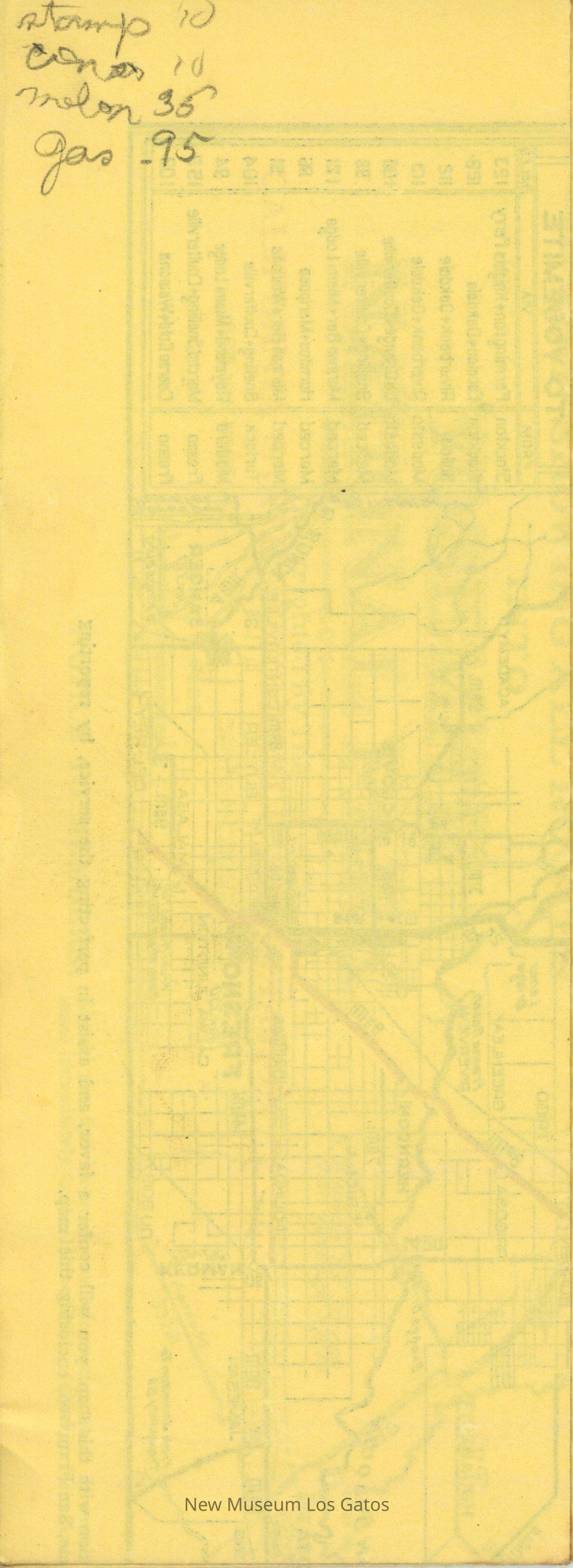
EnglishInscription/Signature/Marks
Type
InscriptionLocation
Back side of mapTranscription
stamp 10
[unintelligible] 10
melon 35
gas - 95Language
EnglishMaterial/Technique
PencilDimensions
Width
3-1/2 inLength
9-1/2 inDimension Notes
Measurements taken while map is completely folded.Relationships
Related Person or Organization
Person or Organization
Dora RankinNotes
Donor