Name/Title
USGS Castle Rock Ridge MapEntry/Object ID
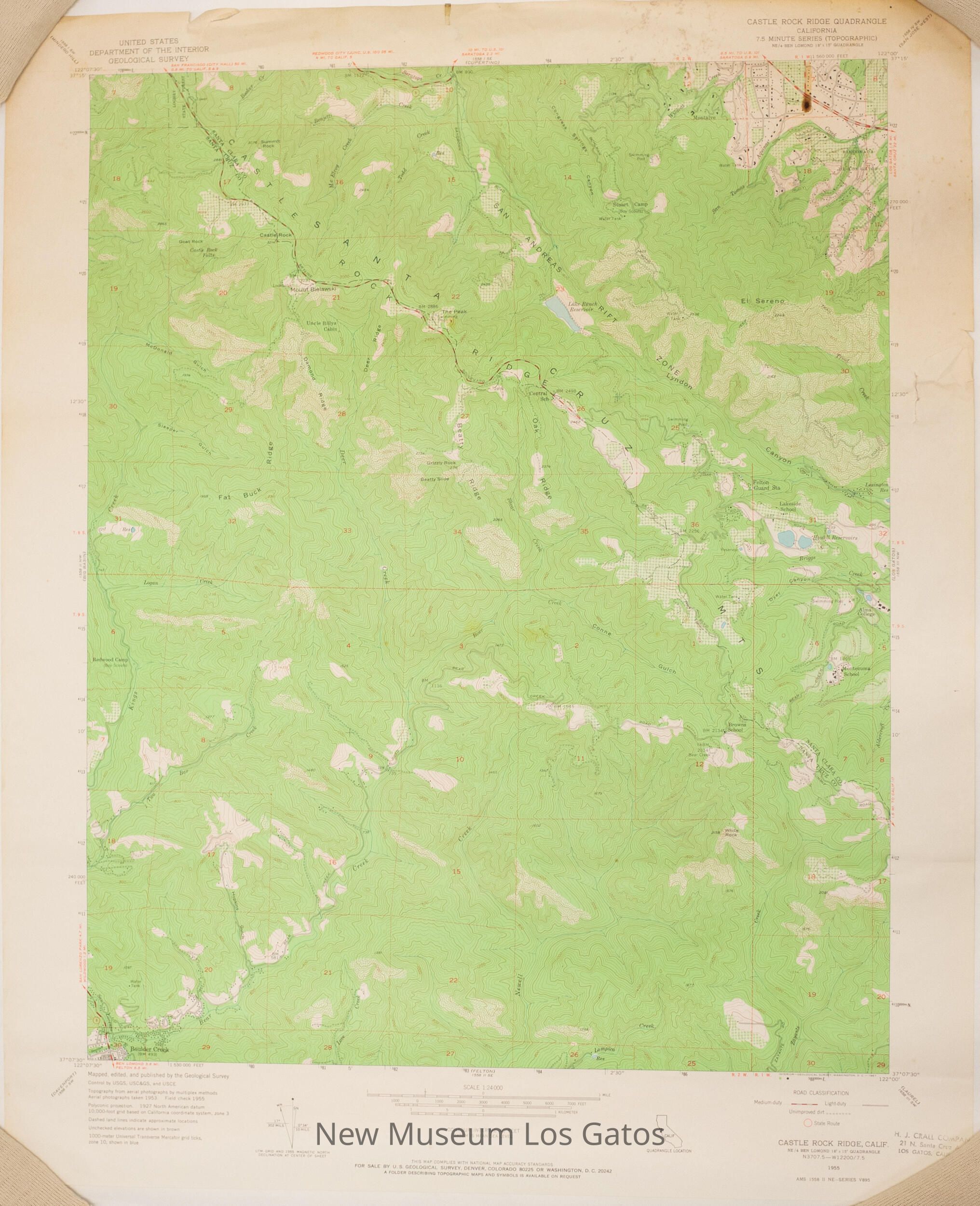
NU 2022.6Description
A topographic, color map of the Castle Rock Ridge quadrangle in Santa Clara and Santa Cruz Counties, California.Collection
History CollectionCataloged By
registrar@numulosgatos.orgLexicon
Nomenclature 4.0
Nomenclature Secondary Object Term
MapNomenclature Primary Object Term
CartographNomenclature Sub-Class
Graphic DocumentsNomenclature Class
Documentary ObjectsNomenclature Category
Category 08: Communication ObjectsMap Details
Maker or Creator
United States Geological SurveyScale
1:24,000Area or Region
Region
Central CaliforniaContinent
North AmericaEdition
FirstDate Published
1955Medium
PaperPublication Language
EnglishInscription/Signature/Marks
Type
InscriptionLocation
Lower right cornerTranscription
6Material/Technique
PenType
LabelLocation
Lower right cornerTranscription
H. J. CRALL COMPANY / 21 N. Santa Cruz Ave. / LOS GATOS, CALIFORNIALanguage
EnglishMaterial/Technique
Stamped, InkDimensions
Width
22 inLength
27 inDimension Notes
Measurements taken while lying as flat as possible.Relationships
Related Person or Organization
Person or Organization
H.J. Crall Company