Forbes Mill Area Map

Name/Title

Forbes Mill Area Map

Entry/Object ID

2023.6.16

Description

A glossy, black and white photograph of a map of the area surrounding the Santa Rosa Flour Mill and the Los Gatos Creek.

Photograph Details

Type of Photograph

Gelatin Print - silver chloride

Subject Person or Organization

Los Gatos Manufacturing Company

Subject Place

Location

Forbes Mill

City

Los Gatos

Region

Central California

Continent

North America

Collection

History Collection, Bill Wulf Collection

Cataloged By

registrar@numulosgatos.org

Acquisition

Accession

2023.6

Source or Donor

William Arie Wulf

Acquisition Method

Gift

Credit Line

Gift of Bill Wulf

Made/Created

Date made

circa 1880

Time Period

19th Century

Place

City

Los Gatos

Region

Central California

Continent

North America

Notes

While there is no date on the map, based on what is depicted, it was most likely created around the 1880s.

Inscription/Signature/Marks

Type

Inscription

Location

Back of photograph

Transcription

HISTORICAL COLLECTION WILLIAM A. WULF LOS GATOS HISTORIAN 822 CATKIN COURT SAN JOSE, CALIFORNIA 95128 297-4947

Language

English

Material/Technique

Stamped

Lexicon

Nomenclature 4.0

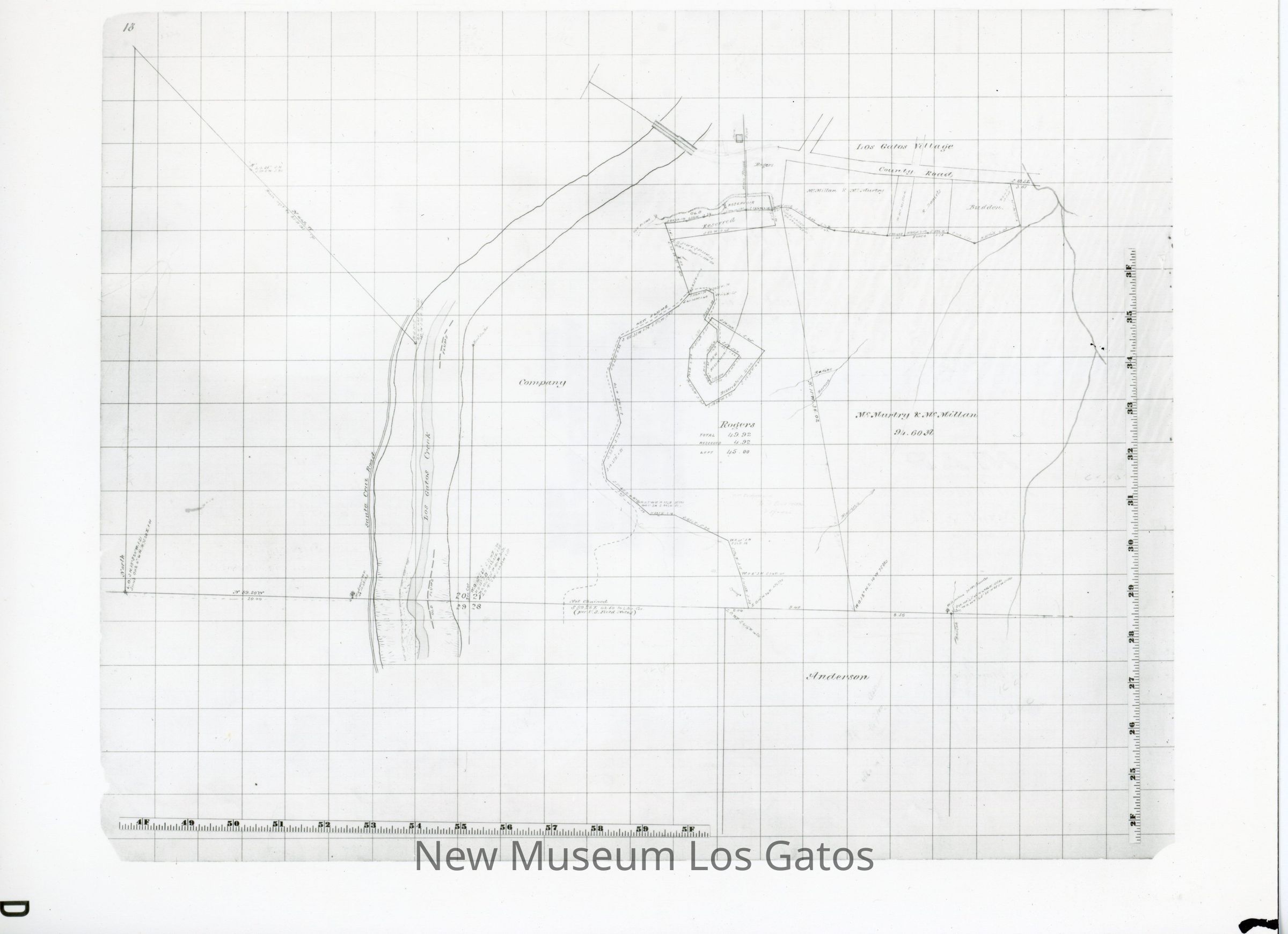
Nomenclature Tertiary Object Term

Survey, Land

Nomenclature Secondary Object Term

Photograph, Black-and-White

Nomenclature Secondary Object Term

Map

Nomenclature Primary Object Term

Photograph

Nomenclature Primary Object Term

Cartograph

Nomenclature Sub-Class

Graphic Documents

Nomenclature Class

Documentary Objects

Nomenclature Category

Category 08: Communication Objects

Dimensions

Width

10 in

Length

7-3/4 in

Condition

Overall Condition

Very Good