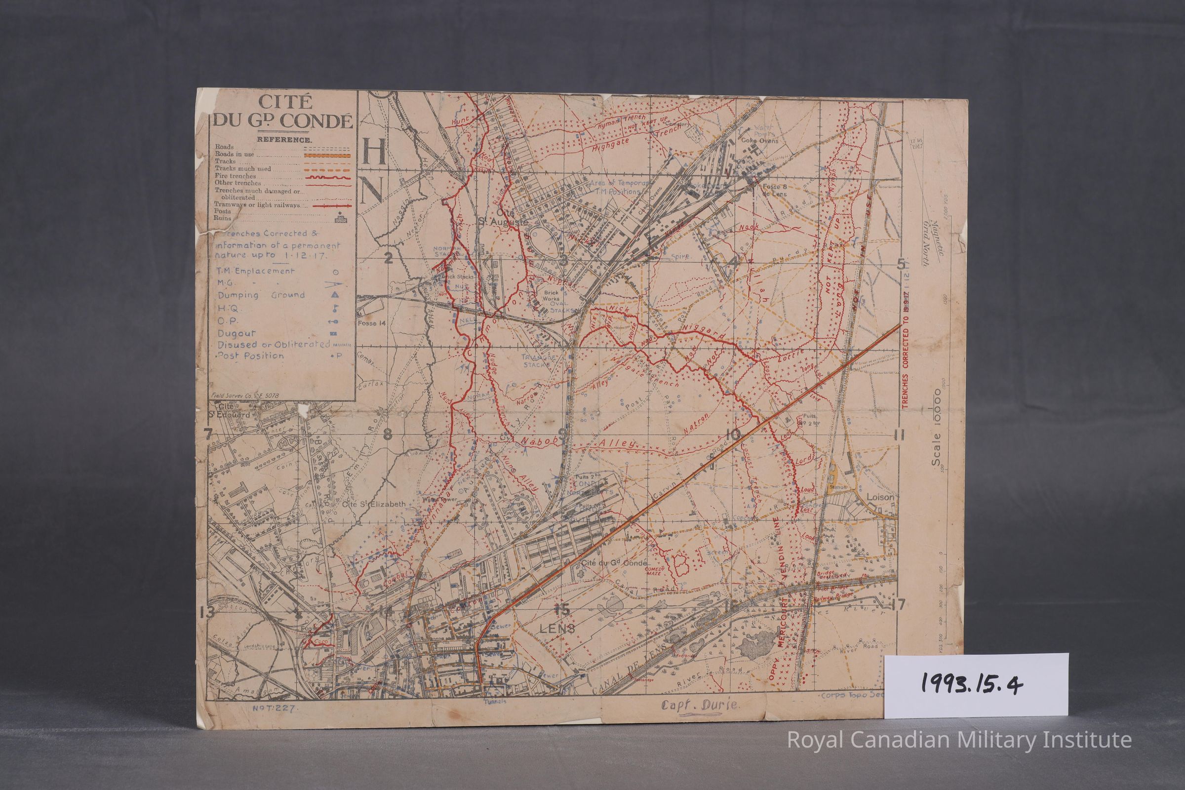
1917 Canadian Corps topographic section map "Cite Du GD. Conde"
Use
Canadian Corps Topographic Section Map detailing towns, villages, roads, rail lines, trench lines, gun and observation positions. Smaller scale of 1:10,000, no form or contour lines.
Context
Smaller scale topographic map with basic details of Lens city area emphasizing frontline, reserve, and dis-used trench line systems.
Made/Created
Artist
Canadian Corps Topographic Section
Date made
Feb 1917 - Nov 1917
Time Period
20th Century
Place
Region
Western Europe
Continent
Europe
Dimensions
Dimension Description
map overall
Height
40 cm
Width
33.3 cm
Dimension Notes
map size 13 x 15.75 inches folds to 4 x 7 inch size