Warrensville Township Map, 1827
Name/Title
Warrensville Township Map, 1827Entry/Object ID
2.2.7Tags
1820s, 19th Century, Warrensville Township, Shaker LakesDescription
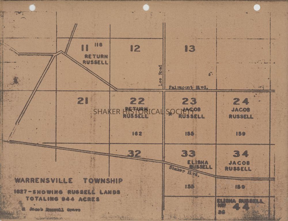
Reproduction 1827 map from an unknown source showing Russell lands in Warrensville Township totaling 944 acres. Lots 11 and 22 are identified as belonging to Return Russell; Lots 23, 24, and 34 as belonging to Jacob Russell; and lot 33 and part of lot 44 as belonging to Elisha Russell. Streets identified as Lee Road, Fairmount Boulevard, and Shaker Boulevard are labeled, although the Shaker Blvd street should be labeled as South Woodland. The Jacob Russell grave is marked with an X in lot 23. NOTE: Map does not seem entirely accurate as Jacob Russell deeded much of his land to his children in 1815-16 and died in 1821. Additionally, staff could not locate deeds that confirm Elisha Russell's ownership of 36 acres in lot 44.Collection
Map CollectionCategory
Maps
Archives