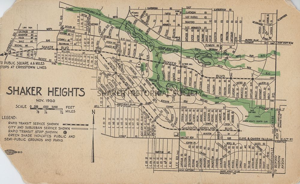
Shaker Heights Map, 1920
Name/Title
Shaker Heights Map, 1920Entry/Object ID
7-77.12Tags
1920s, Shaker Heights, Transportation, 20th CenturyDescription
Postcard from an unidentified publisher featuring a November 1920 map of Shaker Heights. The legend identifies rapid transit lines, city and suburban lines, and rapid transit stops. Green shade indicated public and semi-public grounds and parks. The top left and bottom left corners are missing. A Cleveland Union Label is visible near the bottom left corner. An illegible note is written in pencil on verso.Subject Place
City
Shaker HeightsCounty
Cuyahoga CountyState/Province
OhioCountry
United StatesCategory
Postcards, Maps
Archives