Name/Title
Shaker Development, 1932Entry/Object ID
2024.2.1Tags
1930s, 20th Century, Van Sweringens, Mercer Neighborhood, Shaker HeightsDescription
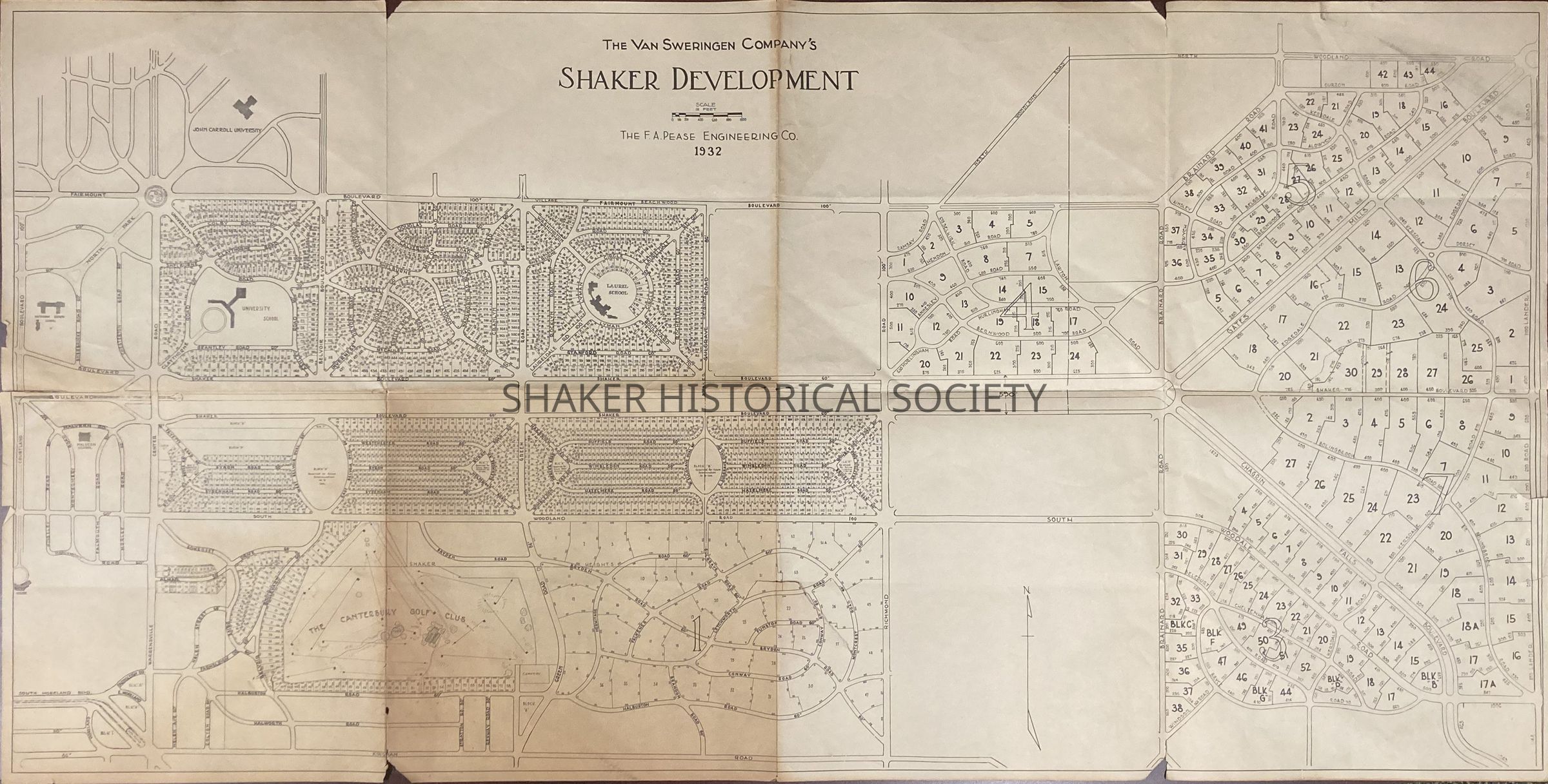
A 1932 map by F. A. Pease Engineering Co. showing development in the Mercer neighborhood of Shaker Heights near University School and Laurel School and proposed development east of Green Road in Pepper Pike, which was known as Shaker Country Estates.Collection
Map CollectionAcquisition
Accession
2024.2Source or Donor
H. Bruce BlonderAcquisition Method
GiftCredit Line
Gift of H. Bruce BlonderRelationships
Related Person or Organization
Person or Organization
Laurel SchoolPerson or Organization
University SchoolPerson or Organization
Van Sweringen CompanyRelated Places
Place
City
BeachwoodCounty
Cuyahoga CountyState/Province
OhioCountry
United StatesPlace
City
Pepper PikeCounty
Cuyahoga CountyState/Province
OhioCountry
United States