Warrensville Township Maps, c.1810
P. 642 a
Name/Title
Warrensville Township Maps, c.1810Entry/Object ID
P-642Tags
1800s, 19th Century, Warrensville Township, 1810sDescription
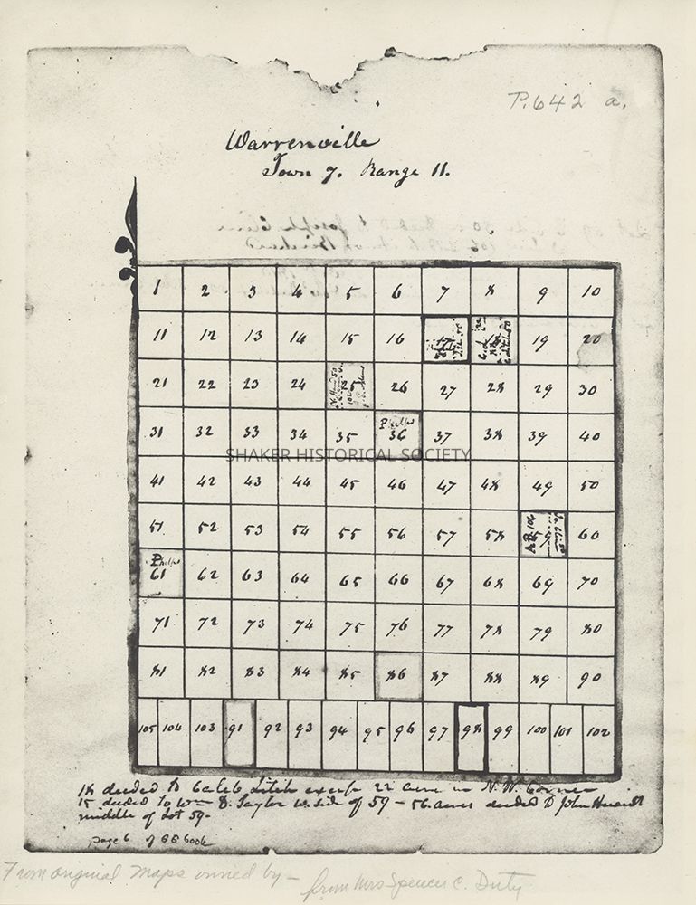
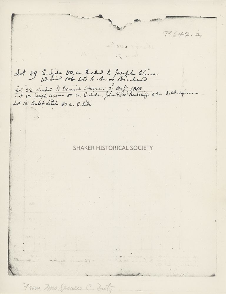
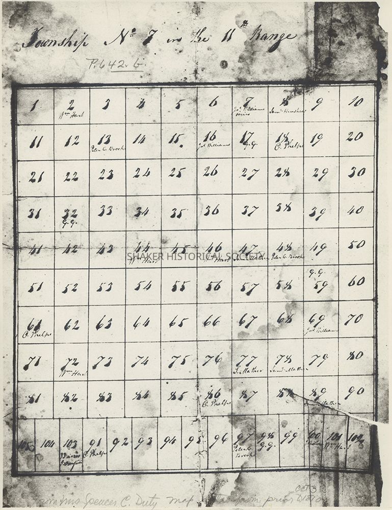
Three reproduction pages from genealogical materials related to the Warren family of Watertown, Massachusetts and Warrensville Township, Ohio donated by Warren family genealogist Allene Beaumont Duty. The first page (P. 642 a) includes a map of lots in Warrensville, Township 7 in Range 11, with early land owners noted and a list of land deeds at the bottom. According to The Warren Family, a genealogical book published by Duty in 1984, this map was made by Judge Calvin Pease, land agent for owner Gideon Granger, Postmaster General under President Jefferson. The second page (P. 642.a) lists land deeds, including the deeding of Lot 32 to Daniel Warren on October 3, 1810. The third page (P. 642.b) includes a map c.1810 of lots in Township 7 in Range 11 (Warrensville) with early land owners noted.Category
Maps
Archives