Shaker Heights, 1919
Name/Title
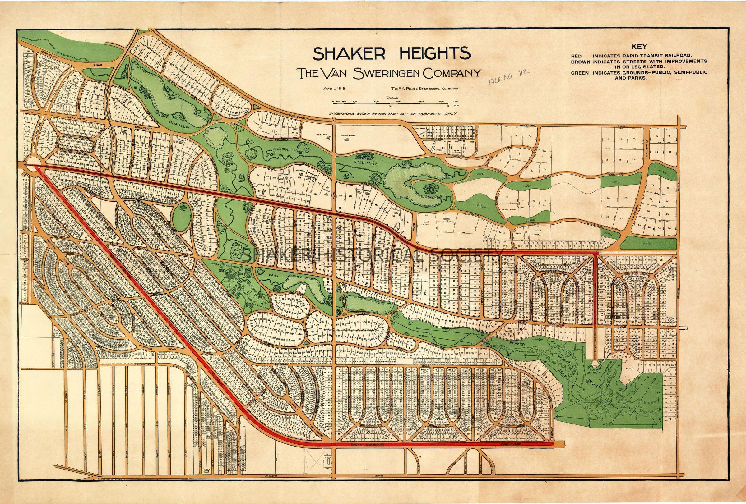
Shaker Heights, 1919Entry/Object ID
4.1.13Tags
1910s, 20th Century, Van Sweringens, Shaker Heights, Shaker Lakes, Larchmere Neighborhood, Malvern Neighborhood, Boulevard Neighborhood, Onaway Neighborhood, Fernway Neighborhood, Ludlow Neighborhood, Cleveland HeightsDescription
Color map of Shaker Heights created in April 1919 by the F. A. Pease Engineering Co., showing lots for sale by the Van Sweringen Company. Rapid transit lines are marked in red, and recreational areas appear in green. Sold lots near the Shaker Parklands are labeled with the owners’ names.Collection
Map CollectionCategory
Maps
Archives