Shaker Heights Village and Vicinity, 1913
Name/Title
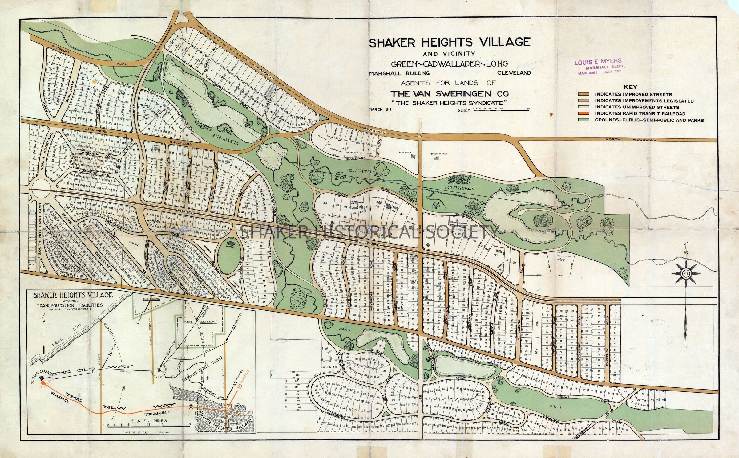
Shaker Heights Village and Vicinity, 1913Entry/Object ID
4.1.8Tags
1910s, 20th Century, Boulevard Neighborhood, Fernway Neighborhood, Malvern Neighborhood, Onaway Neighborhood, Shaker Heights, Shaker Lakes, Van Sweringens, Larchmere NeighborhoodDescription
Color real estate subdivision map from March 1913 for northern Shaker Heights and southern Cleveland Heights Village by Green-Cadwallader-Long for The Van Sweringen Co. The key identifies improved streets, improvements legislated, unimproved streets, rapid transit railroad, and public/semi-public grounds and parks. The map was published shortly after Shaker Heights obtained village status in 1912 and includes an inset map showing transportation facilities under construction.Collection
Map CollectionCategory
Maps
Archives