North Union Map, 1870
Name/Title
North Union Map, 1870Entry/Object ID
7.1.10Tags
1870s, 1960s, North Union Shakers, ShakersDescription
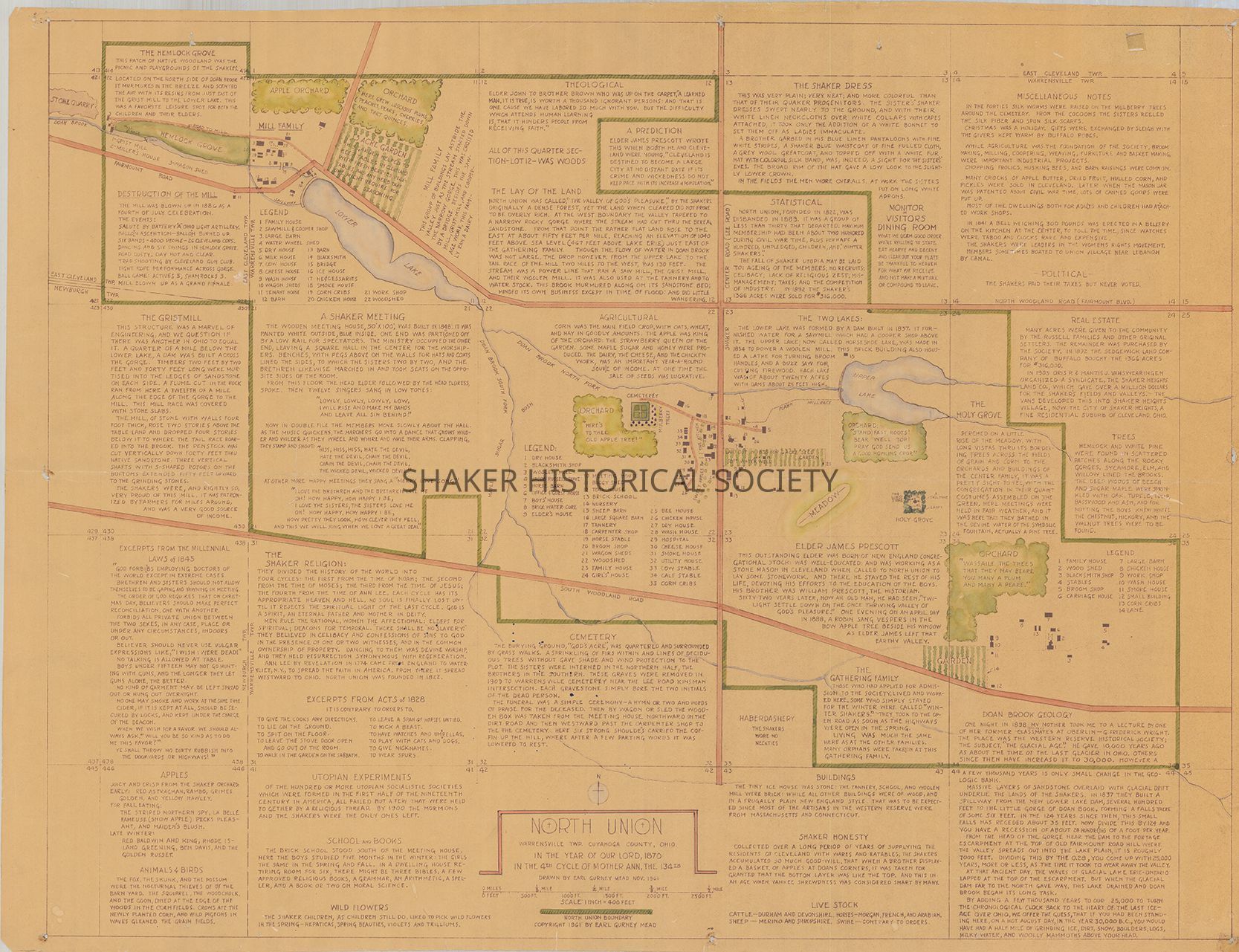
Color map of North Union Shaker Village drawn by Earl Gurney Mead in November 1961. The map includes the Mill Family, Center Family, and East Family; Lower Lake and Upper Lake; and legends identifying Shaker buildings. The map is surrounded by text describing Shaker sites, religious beliefs, customs, and statistics.Collection
Map CollectionCategory
Maps
Archives