Name/Title
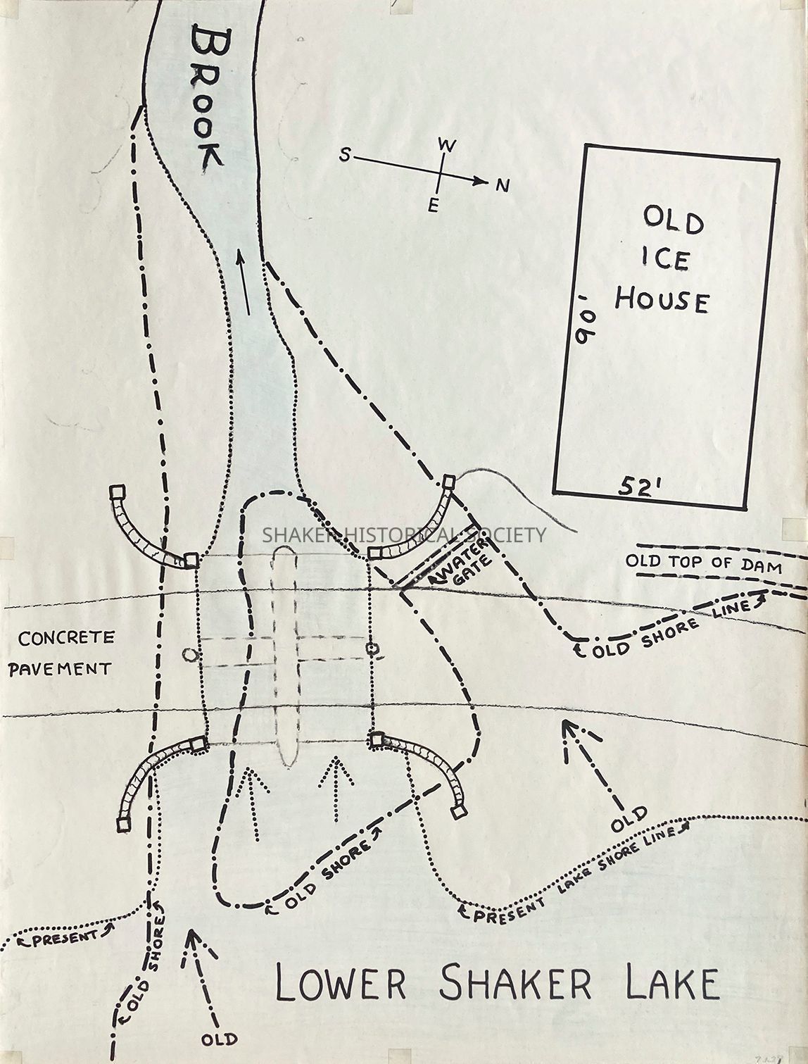
Map of the Shaker Dam at Lower Shaker LakeEntry/Object ID
7.1.27Tags
North Union Shakers, Boulevard Neighborhood, Shaker LakesDescription
Hand-drawn map by Frank Myers of the Lower Shaker Lake dam, including the North Union ice house, top of the original Shaker dam and water gate, northern Lower Lake shore line, and 1897 bridge/present-day Brook Road.Collection
Map CollectionAcquisition
Notes
Donated by Ruthanne Anderson c.1991Location
Location
Drawer
Flat File 7Room
Elizabeth Nord Library & ArchivesBuilding
Shaker Historical SocietyDate
August 2, 2023Relationships
Related Person or Organization
Person or Organization
North Union Shaker VillageRelated Places
Place
Neighborhood
BoulevardCity
Shaker HeightsCounty
Cuyahoga CountyState/Province
OhioCountry
United StatesTownship
Warrensville Township