23BN1 Profile Sketches

Click for full PDF
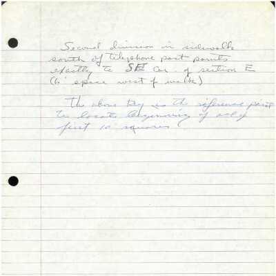
The image depicts a page of lined notebook paper with handwritten notes in cursive, using blue and black ink. The writing appears to provide instructions or directions, mentioning specific locations such as a sidewalk, telephone post, and section E, along with measurements like "6' space west of walk." The text references points for locating or marking certain areas and notes the beginning of a sequence involving "first 10 squares."