Name/Title
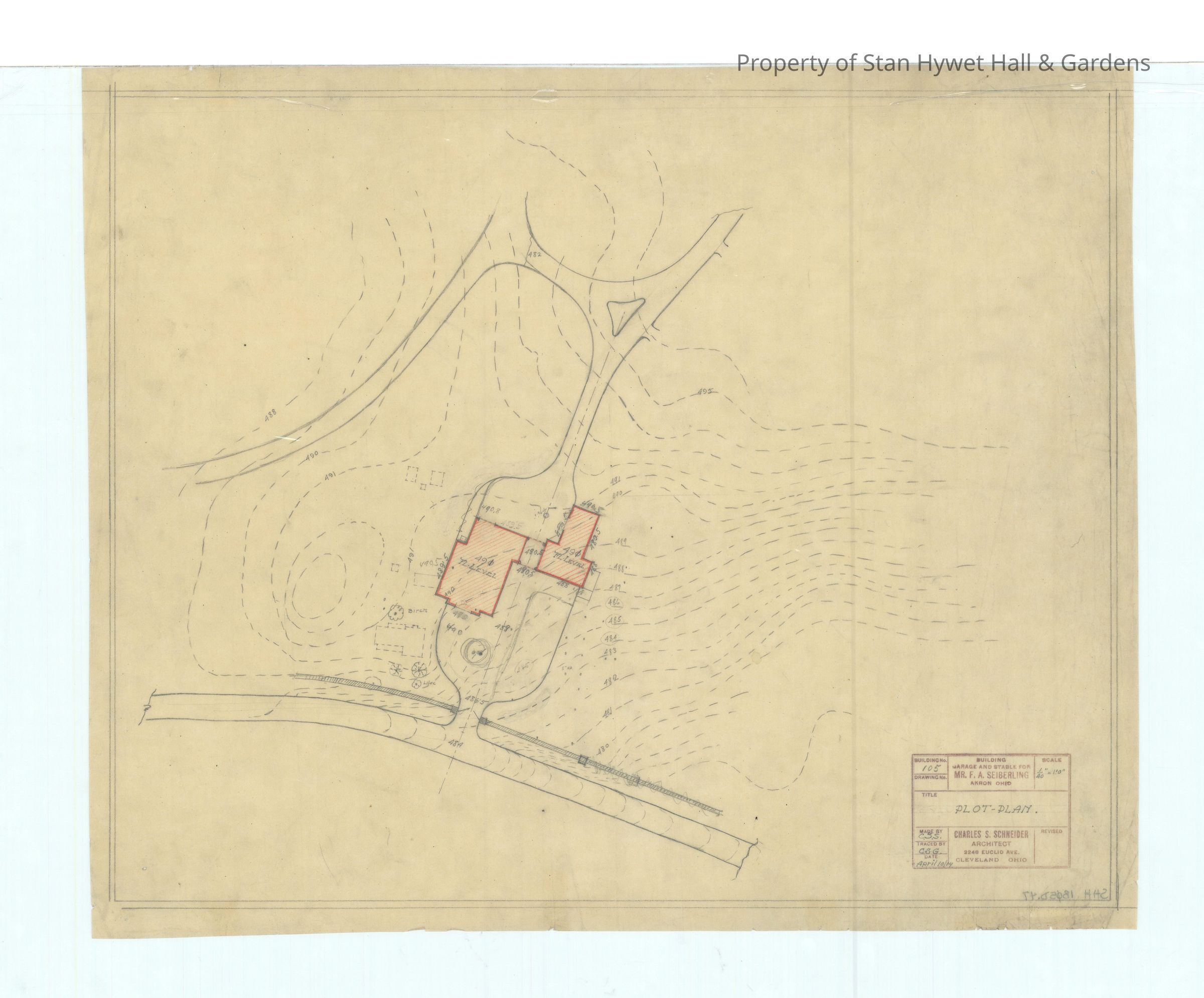
Drawing: Topographic map of portion of land with Carriage HouseEntry/Object ID
SHH 2023.172.195Scope and Content
Historic drawing: Topographic map of the portion of land with the Carriage House and parts of driveway. Titled "Plot Plan".
Scale 1/40" =1'
Signed C.S.S. & C.S.G.Collection
PERMANENT COLLECTIONCataloged By
Chloe WingardAcquisition
Accession
SHH-OriginalSource or Donor
Seiberling HeirsAcquisition Method
GiftArchive Details
Creator
Schneider, Charles SumnerDate(s) of Creation
Apr 10, 1914Other Names and Numbers
Other Numbers
Number Type
Old NumberOther Number
SHH 1B01D.47Created By
cwingard@stanhywet.orgCreate Date
December 11, 2023Updated By
kneff@stanhywet.orgUpdate Date
November 3, 2025