Description
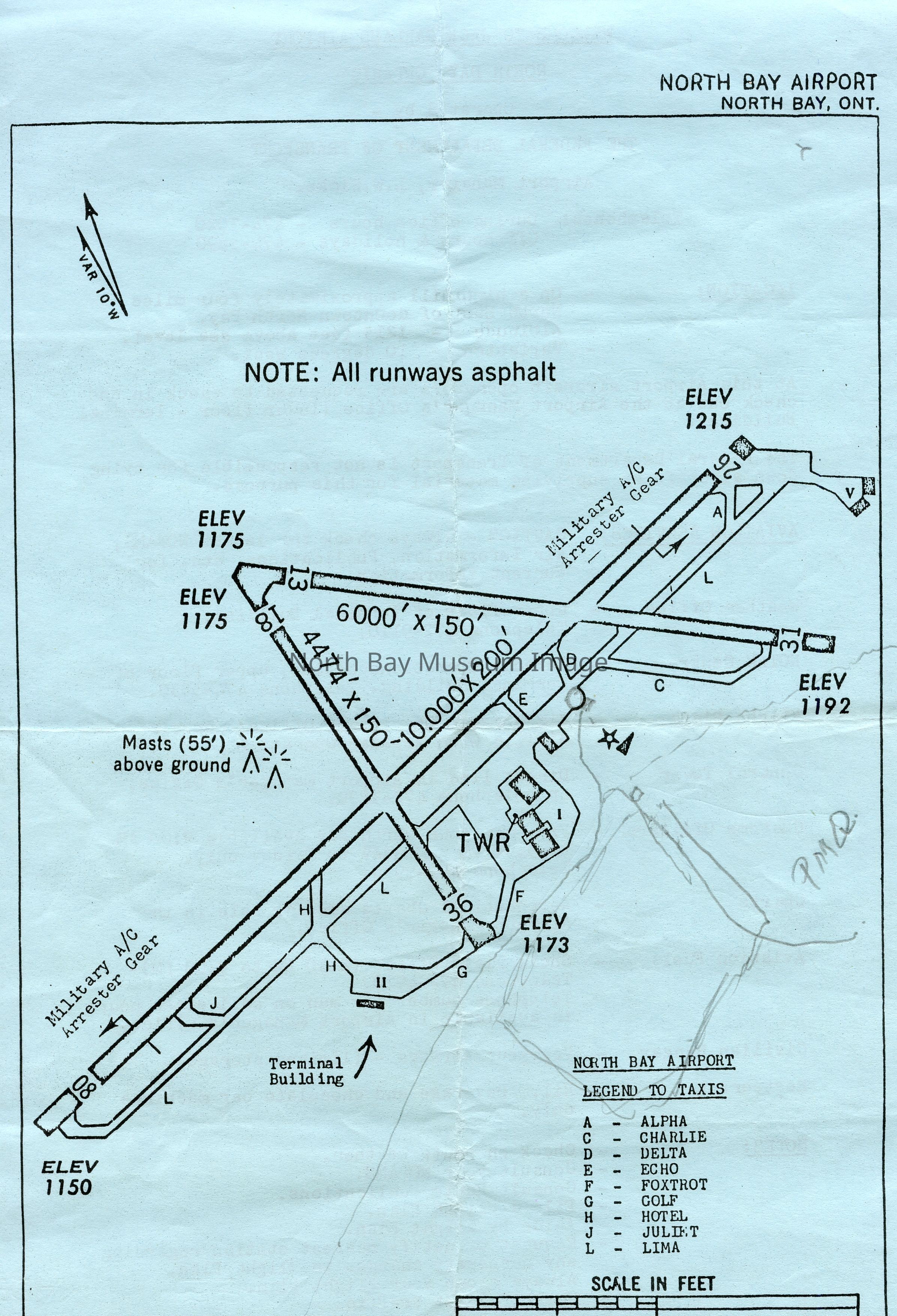
Handout with airport information including location, aerial drawing of runways and buildings, and contact information for various components of Aviation Services.
Information provided by Captain Doug Newman:
, the "PMQ" in pencil refers to where military houses are
located. The penciled square beside it (the square tilted onto one corner)
is where the military buildings are. There is a penciled line that starts
at the bottom of the chart, rises through the first E in ELEV 1173, comes
to a 'Y' intersection, then traces left to a small circle just to the left
of a star and arrow. Beside that circle is where the original airport
terminal sat, from 1938 until the mid-1960s. That penciled line you traced
is the original route of Airport Road. The 'Y' shows where a new road was
created in 1950 to lead into the air force base.
The "Military A/C Arrester Gear" at both ends of the longest runway refers
to a cable system used to bring landing fighter jets to a halt. The some
jets that flew at North Bay were very fast airplanes. Upon landing the
pilot would lower a hook from the bottom of his jet, and the hook would
catch the cable. The cable would reel out a distance, bringing the fighter
jet to a short, quick stop. These were installed at North Bay in 1962, and
were removed circa 1992, when the air base's airplanes were posted to other
parts of Canada.